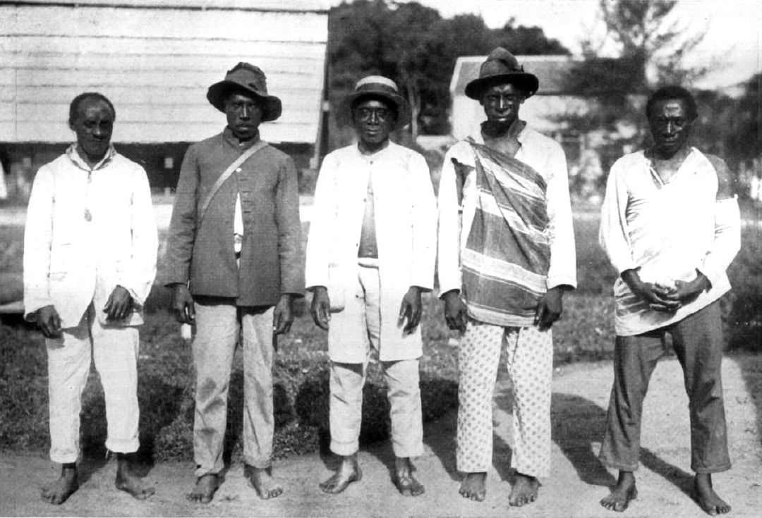
Lowe Nenge [Matawai language]: the fugitives.
Note: no information has been shared here without permission from community members, and some locations have been intentionally obscured.
“And the Matawai escaped into the forest. Sometimes they returned to the plantation at night to get machetes, axes, and other things to take away. In the forest they made gardens, burning the fields and planting rice from the seeds they had carried in their hair. There were older people with them who knew all kinds of obia. For example, there was one that prevented defeat, and another that let them go long periods without food.” (Leo Emanuel in Price 1983)
It is not known exactly when the Matawai ancestors made their fateful escape from the plantations, but according to the oral histories of the Matawai, the Matawai ancestors were descendants of formerly enslaved Africans who ran away during the English period before 1667. The scarce historical record also indicates that they began settling along the Saramacca river by the 1730s.
One of the most well known maps of colonial Suriname from this era was made by Alexander de Lavaux in 1737, called Algemene kaart van Suriname ("General map of Suriname"). Shown to the right is an embellished version from 1757, with the same information as Lavaux's original map twenty years prior.
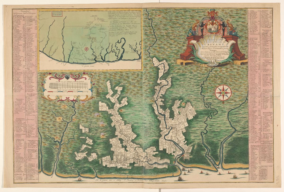
At the time of Lavaux's map, the Saramacca River had not been colonized as of yet.
Here, we see the maximum extent of the plantations as of 1737. These were found primarily along the Suriname, Commewijne, and Cottica rivers.
Plantations would only start to be built along the Saramacca several decades later.
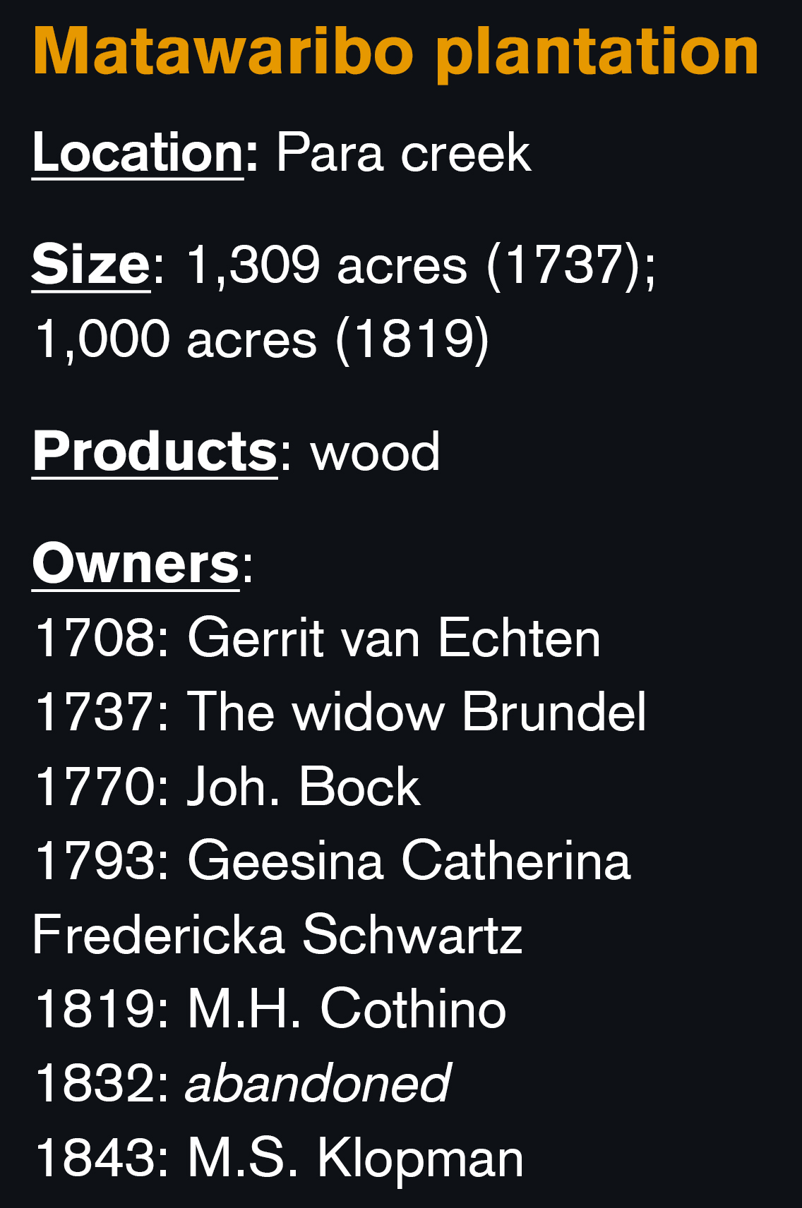
As early as 1708, a plantation along the Para creek (a tributary to the Suriname river) called "Matawaribo" appears on the colonial registers and maps. In formal Dutch the Matawai are referred to as Matawariërs ("Matawariboans").
This plantation is highlighted here on Lavaux's map in orange.
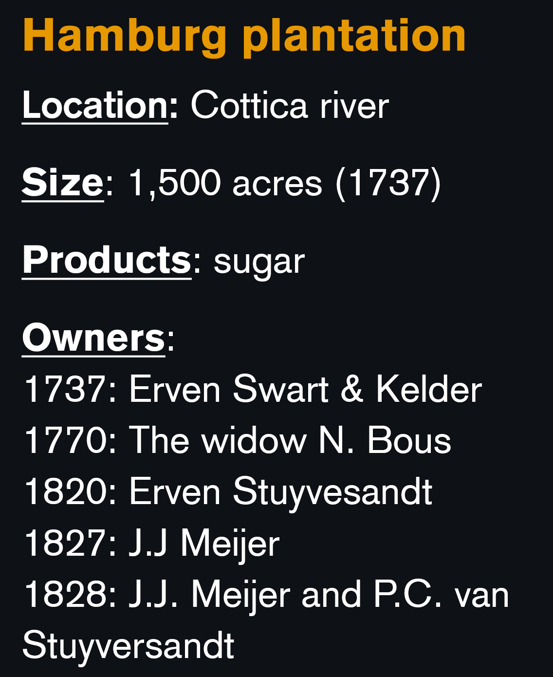
However, the Matawai themselves affirm that their ancestors came from nearby the plantation Hambolugu (Hamburg), located near the junction of the Lower Saramacca River. This plantation did not come into existence until much later, however.
One possibility is that the Matawai oral history refers to another plantation called Hamburg located along the Cottica River (highlighted in orange). This plantation was founded much earlier, and can be located on Lavaux's map. However, this has not yet been confirmed by research.
It may no longer be possible to determine the exact origin of where the ancestors of the Matawai came from, but what is certain is that after several years of staying close to the plantation to steal provisions and rescue enslaved Africans, they escaped far south along the Saramacca River.
To evade the Dutch, the fugitives traveled as far as they possibly could, not stopping until they reached the headwaters of the Saramacca River. The anthropologist Edward C. Green recounts the story of escape he heard in the early 1970s.
“There were four original runaways, Mother Tjowa, her husband, Father Akuai (Akuali), his brother, Apetepeebi Kalukaka, and his wife. Tjowa, Akuai, and their few followers ran away along the west side of the Saramaka River, keeping hidden in the bush in the day to avoid search patrons on the river. Apeetepeebe ran away on the east side of the river.” (Green)
According to Matawai oral history, the ancestors settled in the mountainous headwaters of the Tukumutu River (a tributary to the Saramacca) close to the tepui mountain Tafa Beligi (Table Mountain) at a site they called Hansesipo, or "beautiful rope."
!["Southwest scarp [of Tafelberg] where the wall is well over 300 meters high." Notes on the Geology and Geography of Tafelberg, Suriname by Bassett Maguire (1945)](images/ch04_07_1587498727035.png)
!["East ridge [of Tafelberg] from the south; Schmidt Mt. and Emma Keten in left background; Saramacca Valley to the right." Notes on the Geology and Geography of Tafelberg, Suriname by Bassett Maguire (1945)](images/ch04_08_1587498828284.png)
Some Matawai contend that Hansesipo was the site of the very first Matawai village, whereas others describe it more as a temporary hiding place used by their ancestors only for a short period of time.
During this time, the ancestors were said to be in possession of very strong obias, or spiritual powers:
“The Adadi obia forewarned the Matawai of the approach of the whites. For the obia to work, the Matawai had to attack the whites with wooden machetes. The Loango obia made Matawais appear like trees or rocks to the white soldiers.” (Green)
What all Matawai agree upon, however, is the preeminent importance of the settlement Toido.
According to Matawai oral history, Toido was a very large village, located proximate to the delta of the Piki Tukumutu and Tupi creeks. It was so large that the Matawai were divided into twelve lo (clan), each with a corresponding landing place. There was also a false landing place to throw off the Dutch troops, and a hideout outpost further downstream.
Some say that Mama Tjowa and Akuai resided here themselves, and that Mama Tjowa birthed eight sons and daughters here, the first generation of Matawai born in freedom.
Note: according to traditional leadership and Matawai elders, the exact location of Toido should not be shared with outsiders who have not earned the trust of the community. An approximate location is shown here.
At Toido, there were escapees that would later form part of the neighboring Saamaka Maroon community. The Matawai say that there was an argument between the Saamaka group and the rest of the village, resulting in the Saamaka leaving the watershed by going up Jawee creek, climbing the Van Asch Van Wijck mountains, and traveling via Muyanwoko creek towards the Suriname river, where the Saamaka reside today.
Edward Green heard an even more detailed story from the Matawai granman (chieftain) Aboné:
“Two of Mama Tjowa's songs were Sambo and Pambo. While Sambo stayed in Toido, Pambo explored the eastern branch of the Upper Saramacca River. One day, he discovered the Suriname river. He found a fish there that was not in the Saramacca River. He brought it back and in the presence of Sambo, put it in the water. The fish died immediately. Pambo took it as a sign that he should take his people and go settle the Suriname river.
In those days the Suriname river was bluish in color and it could not be drunk. Pambo reported this to his brother, and Sambo prepared a special deesi (medicine) to cure the water. Before this time runaways from various plantations ascended the Suriname river, but the conditions of the water prevented anyone from settling. Thus Pambo is the original 'father' of the Saamaka, and the Saamaka are truly brothers of the Matawai.”
The Dutch anthropologists Sterman and de Beet observe that the Matawai and Saamaka maintained regular contact following their split, but relations became tense after the death of the Saamaka granman Abini.
According to the anthropologist Richard Price, Toido is indeed referred to in Saamaka Maroon oral history as being the origin of a group of Saamaka Loangos. The Saamaka share an apuku (forest spirit) song about these fateful days:
“Something happened at the Upper Tukumutu / Son-in-law Yanki, do you hear? / Things were too much for us at the Upper Tukumutu / Son-in-law Yanki, do you hear?”
(Song digitized from Price 1983, attributed to Tebini, 24 July 1976).
The period from the 1730s until the 1760s was characterized by intermittent skirmishes with Dutch soldiers, who on varying occasions embarked on expeditions to raid the Matawai settlement at Toido. The Dutch anthropologists Miriam Sterman and Chris de Beet observe that relations between the Matawai and the government were tense, with Musinga in particular leading several raids on the colony, including the burning of a Moravian mission post by Saron and frequent abductions of women and children (de Beet and Sterman 1981).
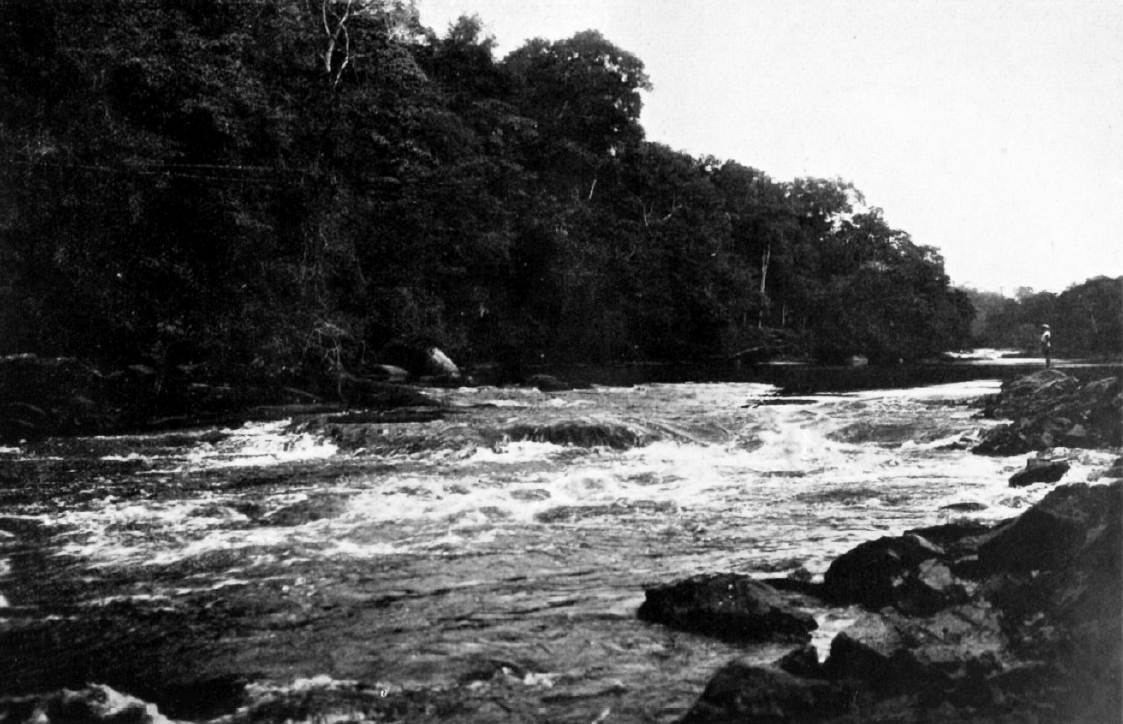
The Matawai recount ambushing the soldiers at Baakafetihila ("fight the whites hill", further downstream) and Keeti dang, a rapid.
While they were living at Toido, they regularly scouted the whites downriver. At Keeti dang they had hidden in the forest, and they knew how to shoot the man steering the boat so that it sank. An obia called akuti warned them whenever the whites were coming... (Price)
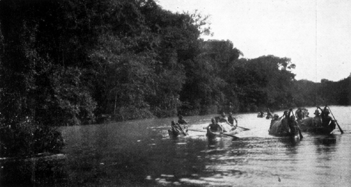
At some point, the overwhelmed colonial administration decided to change course and make peace terms to the Maroon groups residing in the interior. An expedition was sent up the Saramacca River to leave behind a peace offering. (According to Price, this expedition was composed of 250 men commanded by one Captain Evaradus Brouwer.)
The Matawai speak of a soldier called "John", who left behind a cache of goods including rum, cloth, pots, ammunition, and tobacco as a peace offering, on an island in the Tukumutu River. This island became known as Djomasanga, or John's "magazijn" (Dutch for shed or storehouse). But the Matawai refused these offerings, and the elders forbade anyone to go there. According to Matawai oral history, the cache is still buried there on Djomasanga hila.
In 1767, after several more skirmishes and subsequent peace offerings by the Dutch troops, the Matawai finally decided to accept the peace treaty offered by the Dutch. The first officially recognized office of granman (chieftain) was jointly held by the Matawai Becu and Musinga, who as mentioned served as wartime leaders for the group.
This meant that the Matawai could come out of hiding, and move downstream to where the river was broader, the fish more plentiful, and with attractive sand banks or rocks where one could wash or swim.
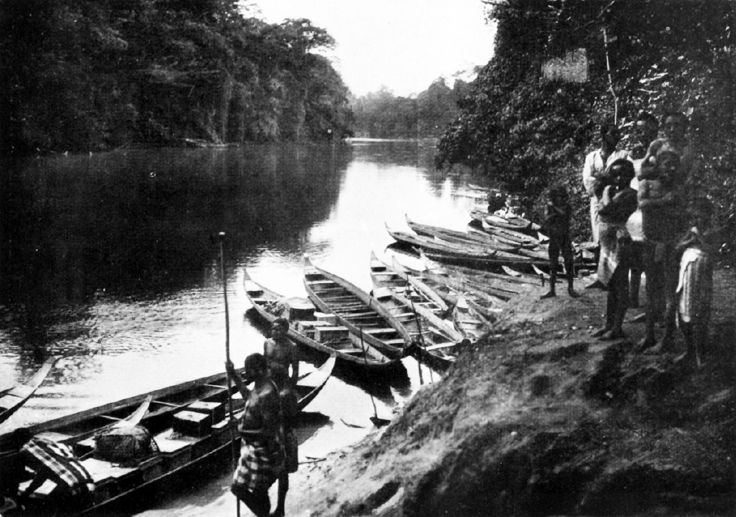
From this time onward, the Matawai embarked on a process of migrating from village to village downstream. Sections of villages would depart from one after a serious argument or fight, or in extreme cases, because a kunu (avenging spirit) was sickening them. Eventually, they came to settle in their present day villages along the upper Saramacca, shown here.
The contemporary Matawai still link their bee (family lineage) and lo (clan) to their ancestral villages. Some current Matawai villages have several bees, while others have just one. Matawai are prohibited from marrying within their own bee.
Gradually throughout the 18th and 19th centuries, members of the Matawai community moved and settled further downstream along the Saramacca River; to be closer to the capital city for trade, to engage in logging for tree species like balata, or simply to move away from family or village members with whom they had an argument.
All of the later downstream villages share the bee and lo of upstream villages, and this continues to be honored today and taken into consideration for marriage customs.
Today, the Matawai occupy and customarily use an area of roughly 650,000 hectares, which can be considered their ancestral territory.
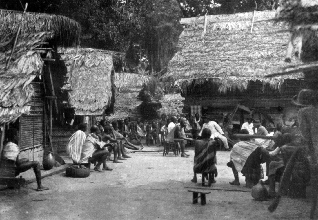
The Matawai are spread across 19 villages, each of which has a traditional leadership composed of several kabitens and bassias, all adhering to the community's chieftain (granman) who resides in the head village of Pusugrunu.
These are just some of the earliest incidents in Matawai history, known to varying extents but always referred to with pride by present-day Matawai.
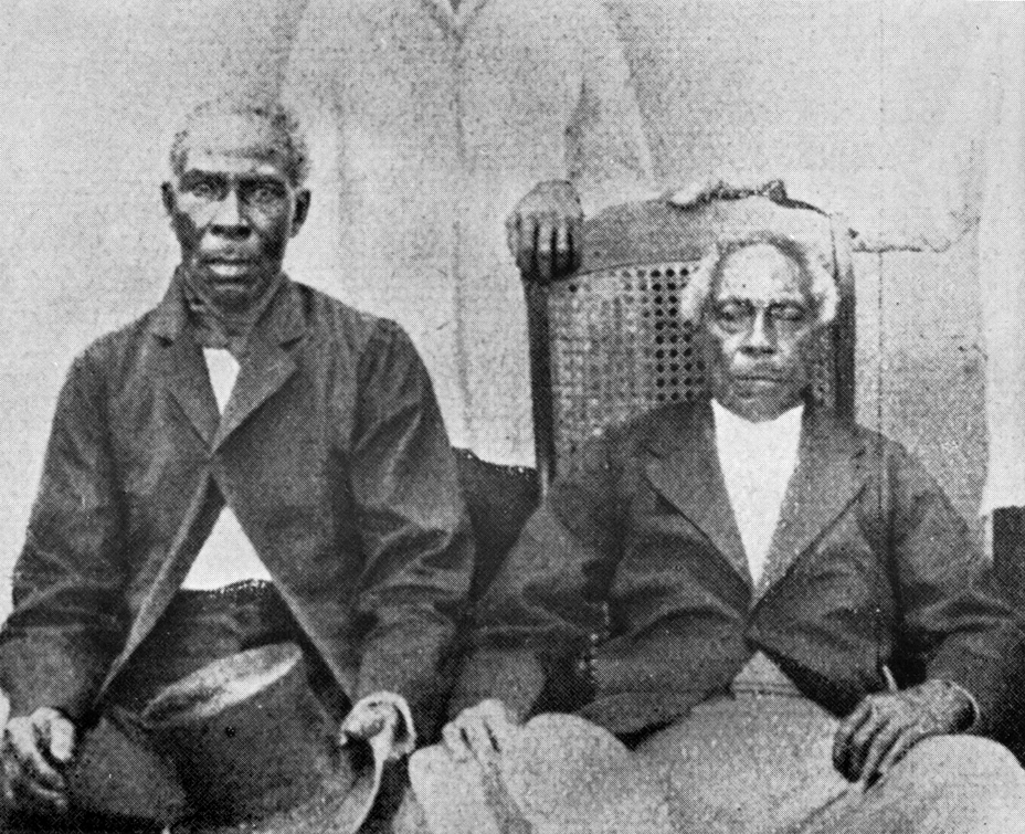
Since those early days, much more has come to pass along the Saramacca river, and no less than twelve gaanman (chieftain) have served at the head of the Matawai.
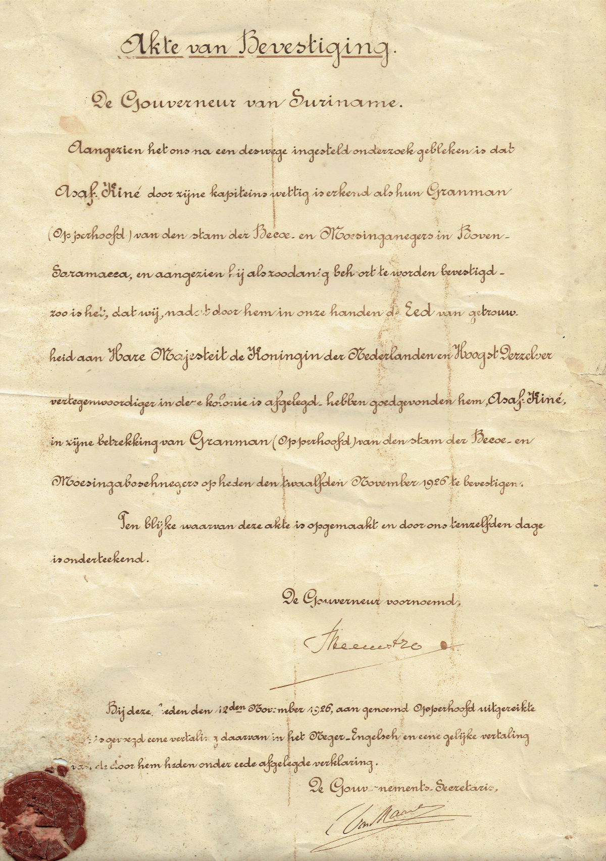
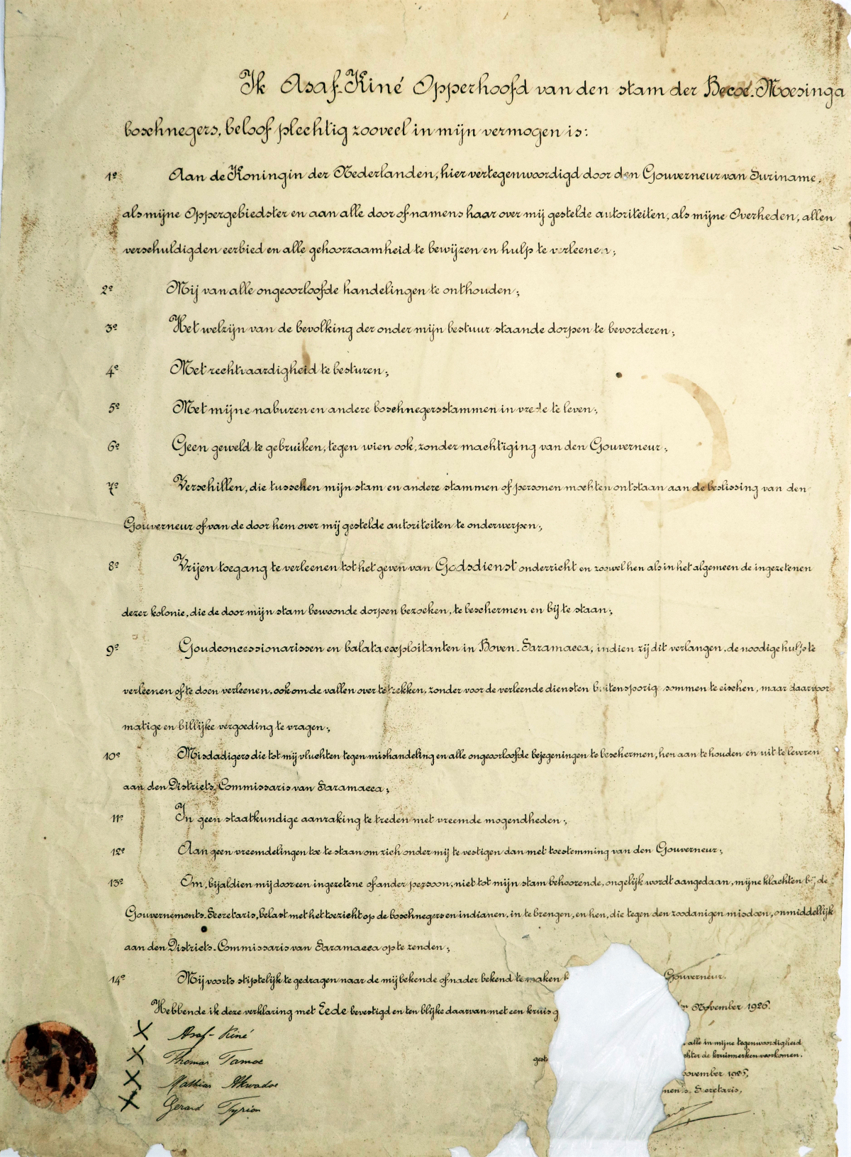
The following document, courtesy of the National Archives of Suriname, is a letter from the Governor of Suriname dated November 12, 1926, officially recognizing the authority of granman Asaf Kiné. In return, granman Kiné was asked to provide a statement of commitments to the colonial authorities.
Act of Confirmation
The Governor of Suriname
"Since it has become clear to us after an investigation that has been made, that Asaf Kiné is legally recognized by his captains as their Granman (chief) of this tribe of the Becoe and Moesinga negroes at Upper Saramacca, and since he should be confirmed as such, so is it that we, after the Oath of Allegiance that we have taken to to Her Majesty the Queen of the Netherlands and Highest Representative in this colony, have approved him, Asaf Kiné, in his position of Granman (chief) of the tribe of Becoe and Moesinga bushnegroes, confirmed on the twelfth of November 1926.
In witness whereof this deed has been drawn up and signed by us on the same day.
The Governor aforementioned,
Aarnoud van Heemstra
To this present day on November 12th, 1926, presented to the said Chief, is added a translation thereof into Negro English, and an equivalent translation of the statement which he has proclaimed under oath.
The Government Secretary."
Courtesy of the National Archives of Suriname.
"I, Asaf Kiné, Chief of the Tribe of the Becoe Moesinga Bushnegroes, solemnly promise as much as in my abilities:
1st. To the Queen of the Netherlands, here represented by the Governor of Suriname, as my Supreme Commander, and to all authorities placed over me by or on behalf of her, as my Government, all owe respect and all obedience and render assistance;
2nd. To refrain from all lawful acts;
3rd. To promote the welfare of the population of the villages under my rule;
4th. To rule with justice;
5th. To live in peace with my neighbors and other bushnegro tribes;
6th. To not use force against anyone without authorization from the Governor;
7th. Differences, which may arise between my tribe and other tribes or persons, will be submitted to the decision of the Governor or of the authorities he puts over me;
8th. To grant the free access to the teaching of religion, and to protect and assist both them and in general the residents of this colony who visit the villages inhabited by my tribe;
9th. Gold concession holders and balata operators in Upper Saramacca, if they so desire, will be provided emergency relief or to have them otherwise provisioned, including for crossover over the rapids, without demanding excessive sums for the services rendered, but asking moderate and equitable compensation for them;
10th. To protect criminals who flee to me from any assault and all ill-treatment, to arrest them and extradite them to the District Commissioner of Saramacca;
11th. Not to enter into political contact with foreign powers;
12th. Not to allow foreigners to settle under me except with the consent of the Governor;
13th. If I am wronged by a resident or other person not belonging to my tribe, to bring my complaints to the Government Secretary, in charge of supervising the Bushnegroes and Indians, and to those who commit such crimes, to be sent immediately to the District Commissioner of Saramacca;
14th. Propose to grade myself to the known or nearer to be announced [...] Governor. Having confirmed this statement with Honor and in evidence thereof with a cross [...] November 1926.
X Asaf Kiné
X Thomas Tamoe
X Mathias Ikwadoe
X Gerard Trypion"
Courtesy of the National Archives of Suriname.
The following map shows a selection of some of the most important Matawai histories in relation to where they took place. Although some important historical sites are named, they are not actually placed on the map, in order to conceal their actual location.
A note on orientation: for the Matawai, north-facing maps are always seen as "upside down", because to go "up" (liba sé) in the Matawai language means to go southward, ascending up the terrain. Hence, when designing a map of Matawai oral histories, we opted to invert the orientation to properly reflect that worldview. (In addition, a south-facing orientation has an additional benefit in reading the map in a mostly linear historical order, since the earliest Matawai oral histories happened in the southernmost extent of the Saramacca river headwaters.)
Mata-what? The origins of the name "Matawai" are contested by researchers and Matawai alike. As mentioned earlier, there was a plantation with the remarkably similar name Matawaribo, and in formal Dutch the Matawai are referred to as Matawariërs (Matawariboans). However, the Matawai have two different accounts about the genesis of their name:
It is derived from a creek upstream from Tukumutu called Weti Matawai.It actually is short for mi an ta wai, which means "I am not happy" in the Matawai language. This refers to the fact that whereas the Ndyuka and the Saamaka signed peace treaties early on, the Matawai were not content to take Dutch peace offerings and continued to struggle for several years longer, as per the Djomasanga story recounted above.
For more Amazon Conservation Team Storytelling Maps, please visit our website at amazonteam.org.
Sources
Cover: detail from map Algemene kaart van Suriname, Alexander de Lavaux, 1757 version.
Cartography and design by Rudo Kemper.
We are grateful to Carl Churchill and Rita Tjin Fooh for reviewing and providing feedback on drafts.