The Matawai are one of the six major Maroon groups in Suriname, each of whom have their own oral histories declaring how they came to settle in what is now their traditional territory.
Since the time of the Matawai ancestors, the situation in Suriname has changed substantially. At the turn of the twentieth century, the agriculture sector along the coastline was in decline, and the economy shifted to resource extraction as precious commodities like bauxite and gold were found in the interior. The Maroons, where were left relatively undisturbed since the time of the peace treaties, suddenly found themselves residing on top of some of the most mineral-rich lands in the country.
From the 1960s onward, the state began to lay out infrastructure into the interior such as a railroad, and major development projects like the large-scale Afobaka dam, which created the 1,500km² Brokopondo reservoir that flooded over a dozen ancestral Saamaka Maroon villages. Suddenly and with vertiginous pace, the Maroons were brought into contact with forces of modernity, facing struggles over the control of their land and with the independence of Suriname in 1975, lost their land rights as given to them by the historical peace treaties entirely. (Recommended reading: Richard Price's Rainforest Warriors, written in 2013)
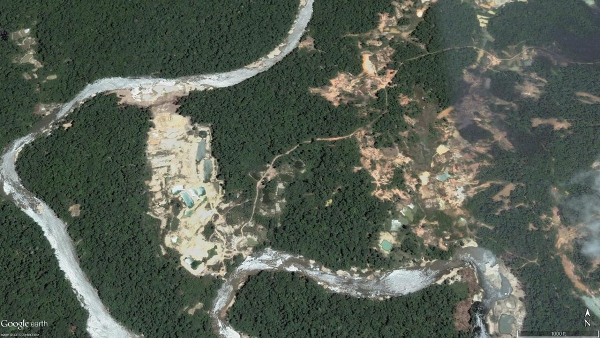
In Matawai lands, small and large-scale gold mining has profilerated extensively since the 1990s. The gold mining activity is both a driver of deforestation, and a source of pollution as mercury is used to isolate the gold from the rest of the soil, and escapes into both waterways and the atmosphere.
Much of the small-scale mining in the region is undertaken by Matawai themselves. With their traditional livelihoods now under threat as a result of environmental degradation, gold mining as a profession is becoming even more ubiquitous.
Community members are concerned that gold mining is resulting in the erosion of traditional Matawai culture and engendering jealousy, greed, and strife within the community. (To learn more about mining in Suriname, visit the ACT storytelling map Amazon Gold Rush: Gold Mining in Suriname)
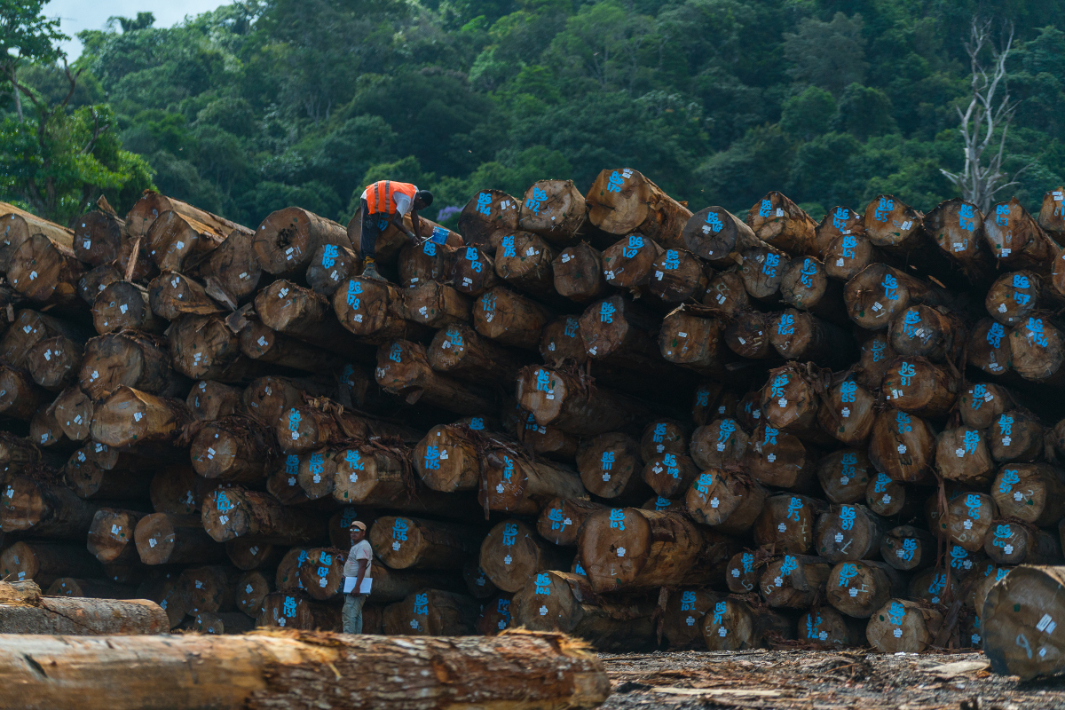
Additionally, in recent years selective logging has become widespread, with an extensive networks of logging roads connecting the previously remote Matawai villages to the rest of the country. Where it used to take over a week to arrive at the Upper Saramacca region by canoe or an expensive charter flight, it is now possible to drive there from the capital city of Paramaribo in no more than five hours.
As a consequence, many of the Matawai villages are left nearly entirely abandoned, with only a handful residents living there permanently. Elderly couples are continuing to live in the traditional way, but their children and grandchildren are residing in Paramaribo or working in the gold mines, and only visit briefly for ceremonial occasions such as weddings or funerals.
For this reason, the Amazon Conservation Team (ACT) is taking action to help the Matawai safeguard their intangible cultural heritage. Since 2015, ACT has been partnering with the Matawai civil society organization Stichting voor Dorpsontwikkeling Matawai to use a participatory methodology training young Matawai to record and interview their elders about Matawai oral history.
To date, the initiative has yielded over 17 hours of footage covering more than 150 historically significant places along the Saramacca River. For a number of the young Matawai involved in the project, it has brought them their first real opportunity to hear any oral history about their homelands.
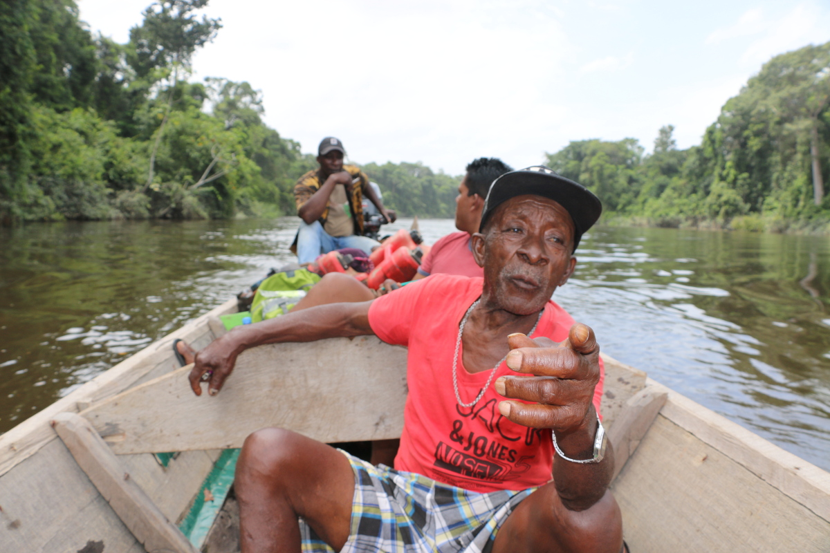
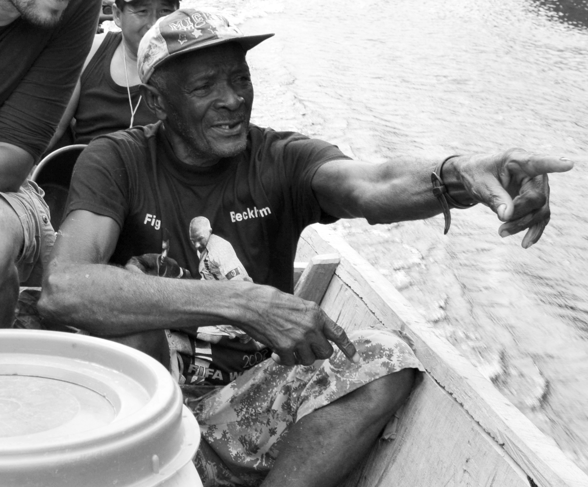
Starting in 2015, ACT hosted several river expeditions composed of young and elder Matawai. The elders, who have traveled the rivers countless times over the years and have an intimate knowledge of the geography, shared the numerous place names, which the younger Matawai jotted down and recorded with GPS.
For the Matawai elder Josef Dennert who participated in one of the river expeditions, the project made him realize that...
“…my inner wiseman had been sleeping all this time, but then I realized it was not too late. I had to follow them and finally apply my knowledge.”
Photo: Rudo Kemper
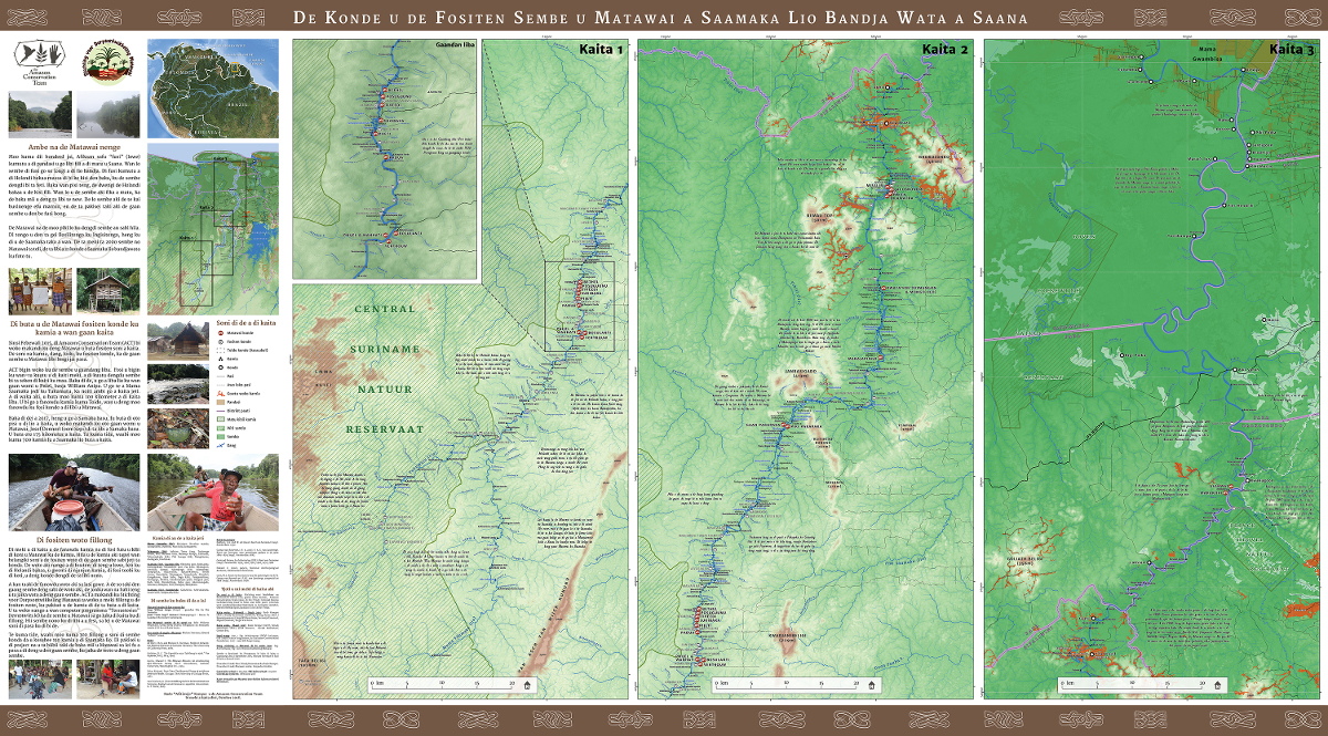
The expeditions have resulted in the mapping of over 700 places with a historical or sacred significance for the Matawai. In 2017, Stichting voor Dorpsontwikkeling Matawai and ACT produced the first comprehensive Matawai ancestral lands map, translated entirely into the Matawai language.
The Matawai community have full ownership and copyright over this map, and decide who gets to view its content.
Map: ACT, with permission from community.
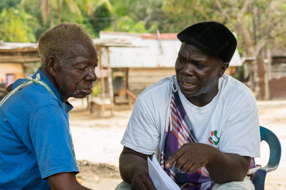
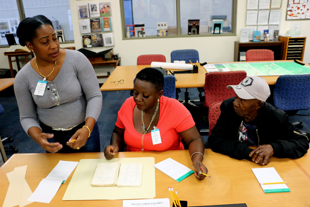
Back in the villages, the younger Matawai sit down again with the elders to ask them about the places and histories that were mapped during the river expeditions.
34 elders from villages across Matawai were interviewed at length, with as many points of view represented as possible.
For younger Matawai like Rolien Sallons, she was enthusiastic to hear certain Matawai oral histories for the first time.
"I was young when I left to the city, so I didn't get the opportunity to learn about my people's history. Now I am finally learning, for the first time, so I can pass the same stories along to my children."
Photo: Rafael Jantz
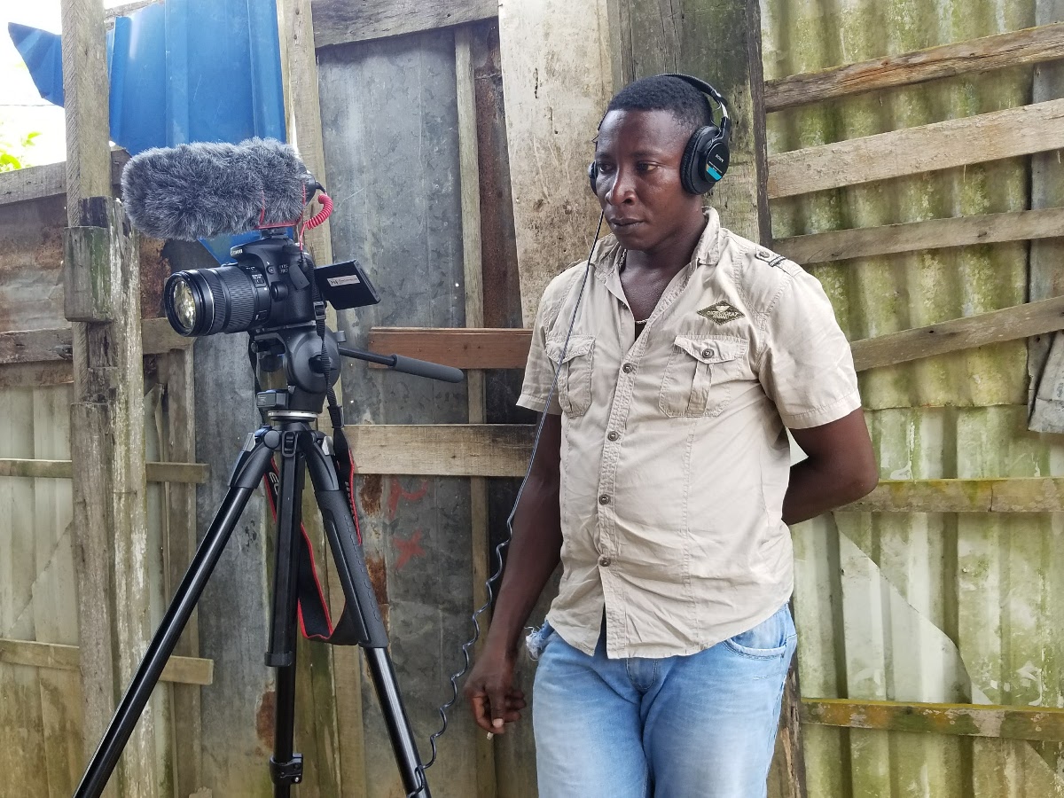
These conversations are being filmed by other Matawai, who have learned to use recording equipment, and are passing these skills along to other Maroon and indigenous groups in Suriname who are interested in recording their own community's storytelling traditions.
Members of Stichting voor Dorpsontwikkeling Matawai and ACT are sharing with other communities what they have learned in the duration of the project. Several collaborations with the neighboring Maroon communities are forthcoming in the future.
Photo: Rudo Kemper
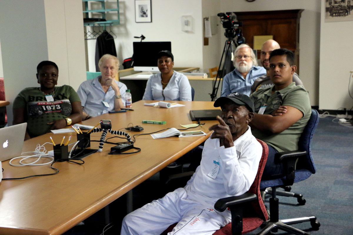
The effort to document and preserve the community’s oral histories has led the Matawai to seek out support from a number of institutions—some very far removed from their homelands. In September 2018, Dennert, along with two other Matawai, traveled to Washington, DC to research the papers of Edward C. Green at the Smithsonian Institution.
Green, an anthropologist, amassed a collection of field notes, photographs, and audio recordings captured during his time with the Matawai in the early 1970s–all of which were recently donated to the Smithsonian’s National Anthropological Archives. Sponsored by the Smithsonian Institution’s Recovering Voices Program, the three Matawai researchers were able to access these invaluable historical materials for the first time, and were permitted to take back copies to share with the rest of their community.
Photo: Antonio Peluso
At the end of the experience, basja (traditional leader) and research participant Tina Henkie reflected on the process:
“These anthropologists wrote things down, while my people back then couldn’t write. But they told stories, and then the anthropologists recorded them. And now that the people aren’t with us anymore, we should be able to find the story somewhere. And that is what we’re doing now here at this archive; I try to imagine how my ancestors lived back then. And that gives me a feeling of pride to be a Matawai, because it helps me know my roots.”
Photo: Rudo Kemper
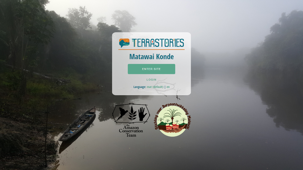
To enable hosting of the recordings of oral histories, and linking of the histories to maps of the ancestral homelands, ACT collaborated with Ruby for Good, a team of volunteer developers, together building a novel geostorytelling application called Terrastories.
Terrastories is a geostorytelling application built to enable local communities like the Matawai to locate and map their own oral storytelling traditions about places of significant meaning or value to them.
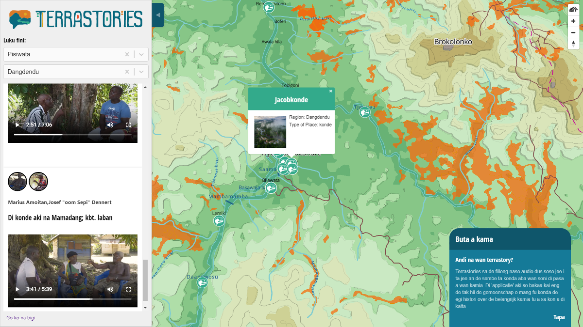
The application interface consists of an interactive map and a sidebar with media content and stories. Using a content management system, the Matawai can add places and stories, and make decisions about designating certain stories as private or restricted. The content of the application is entirely translated into the Matawai language.
Terrastories works without internet access, and the code is open-source so that any community in the world can adapt it to map their own place-based storytelling traditions.
Terrastories is designed to be fun to play with, built with the younger generations specifically in mind.
The application can load on laptops and smartphones, and the Matawai can access recordings of the oral histories by using the interactive map, or by filtering for the stories. Terrastories will then zoom to the location on the map where the story takes place.
Photo: Kalimar Maia
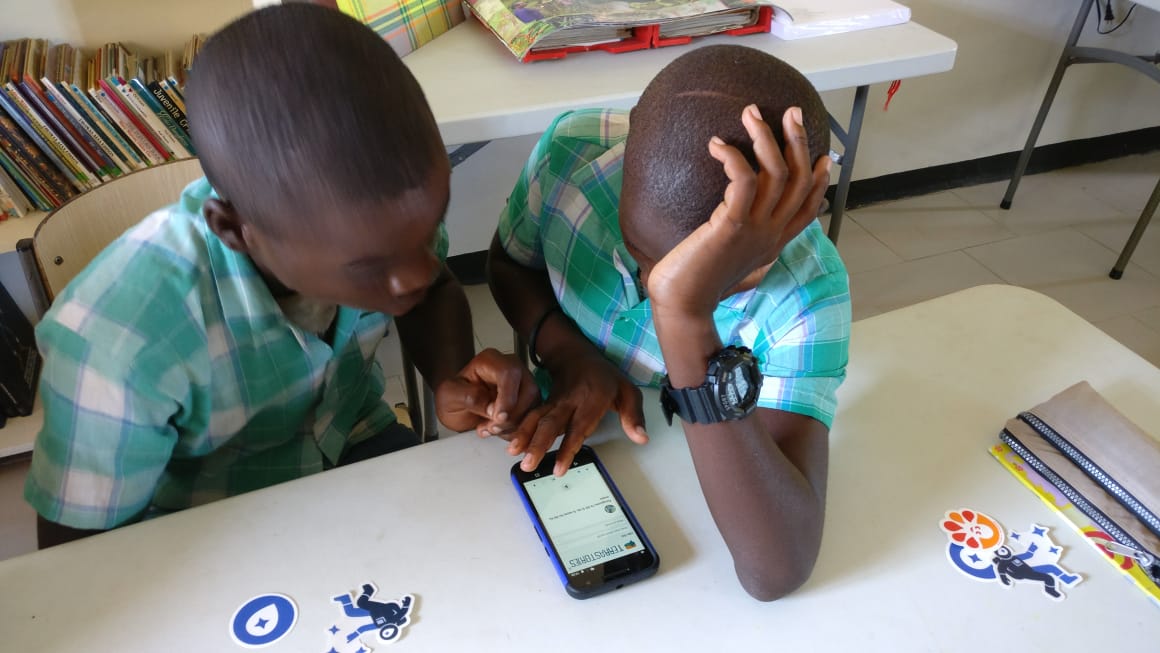
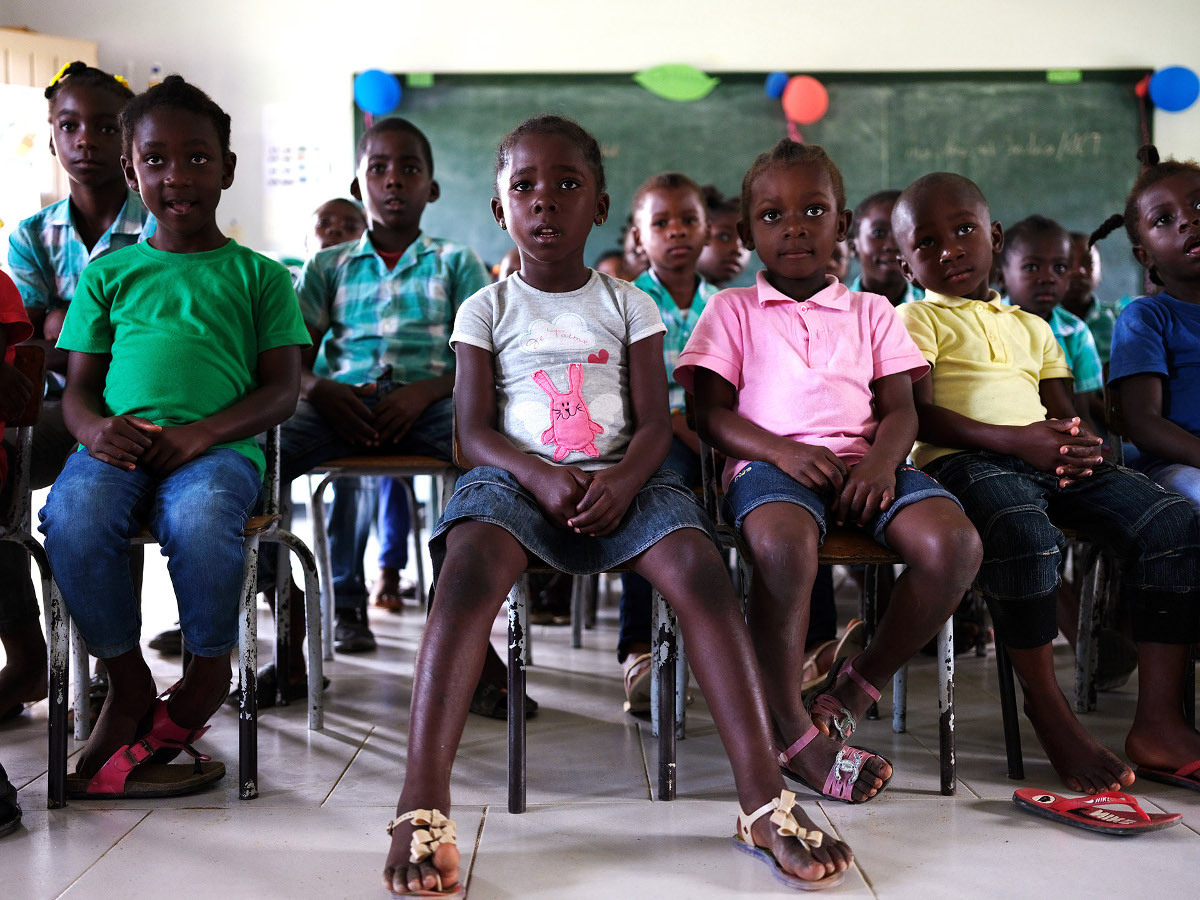
The school teachers at the primary schools in Matawai lands have embraced the project and Terrastories. According to Paul Redmond, the principal of the public school in Pusugrunu,
...this is really an invaluable tool. Our school is in dire need of resources to make the lessons more engaging and meaningful for the children, and we have a tool to teach history, geography, language, computer skills, and culture all in one.
Photo: Amit Madheshiya
In October 2018, in Paramaribo, Stichting voor Dorpsontwikkeling Matawai and ACT presented a version of Terrastories fully populated with all of the Matawai stories and maps before an audience of Maroon community members, traditional leaders, and Surinamese government officials. The project has spurred a national conversation around recognizing and protecting the Surinamese Maroon culture as intangible cultural heritage, and ACT has published a methodology guide to consolidate the knowledge gained through the process.
The value of obtaining recognition as intangible cultural heritage would be immeasurable for the Matawai, and Suriname at large. As UNESCO observes,
“The importance of intangible cultural heritage is not [just] the cultural manifestation itself, but rather the wealth of knowledge and skills that is transmitted through it from one generation to the next.”
For the Matawai, such knowledge includes an understanding of the immeasurable value of their ancestral forests, and provides a solid justification for leaving the landscape intact rather than viewing it as a resource, as supported by recent research demonstrating that storytelling empowers indigenous peoples to conserve their own environments.
In summation, the continued cultural resilience of communities like the Matawai, through the continued transmission from generation to generation of their heroic oral histories about struggling to fight for their right to exist in freedom, benefits us all.
We gratefully acknowledge the partners who have made this storytelling map possible:

In memory of bassia William Anipa of Piniël, wan gaan Matawai womi.

For more Amazon Conservation Team Storytelling Maps, please visit our website at amazonteam.org.
Sources
Cover: photo by Rafael Jantz.
Cartography and design by Rudo Kemper.